
GOOD CONTROL SURVEYS LEAD TO BETTER CONTROL POINTS

Engineer surveyor working with theodolite at construction site
The evolution of surveying over the years is very impressive. What used to take months to do years ago has been reduced to days or hours in modern-day surveying. There are many different methods used by surveyors. This blog will cover some of those methods. Control survey data has many uses, including establishing control points on a construction job site. To refresh your memory on what a control point is, when you need to establish them, where they should be placed and why they are critical, check out our previously posted blog on construction site control points.
LINK BETWEEN CONTROL NETWORKS & SURVEYS
A control network in surveying is defined as a network, often of triangles, measured using various techniques. We will highlight a few of those techniques later in this blog. Control networks measure positions relative to other positions. In ancient times, control networks were determined, with the first position being comparable to the stars. We've since come a long way with being able to determine positions through the use of GPS.
Control networks enable land surveyors to produce control surveys through various tools and methods of measurement. Control surveys provide the standard for accuracy by establishing horizontal and vertical positions of points, subsequently used for job site planning. The site contractor would use the established control points for setting up the job site, such as layout and Automated Machine Guidance (AMG). If the survey data is inaccurate, it will lead to significant mistakes on the job, which could end up being costly. Another use for establishing control is for mapping purposes. A map's accuracy is only as good as the control network that has been established through the data collected.
SOME CONTROL SURVEY METHODS:
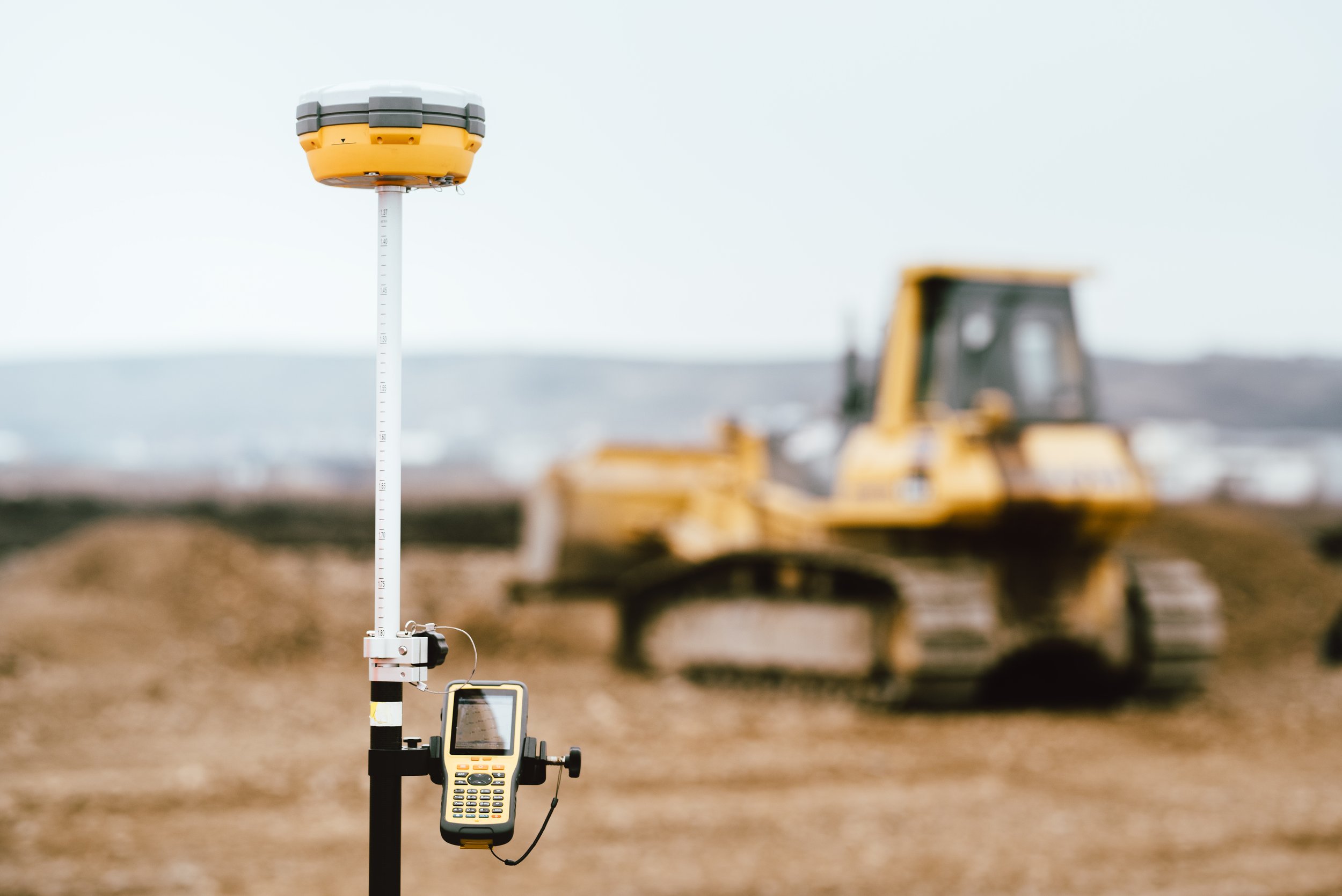
Construction site surveyor GPS system
GPS
Triangulation
Trilateration
The GPS method is extremely precise. It is the most common survey method used because it is fast and accurate. Due to substantial advancements in technology over the years, the GPS's accuracy through satellite-based navigation systems is incredible. The GPS can provide precise estimates of the position, velocity, and time of the system receiver's antenna location through the broadcasting of synchronized timing signals. The technology that surveyors use when deploying this method is more sophisticated, and therefore, it increases the accuracy of the data collected. The receivers used are complex and of high quality. Once the data is collected through the GPS, it can measure between two points and is ultimately used in survey models.
By definition, the triangulation method is the surveying technique in which unknown distances between stations may be determined by trigonometric applications of a triangle(s). It is based on measuring the angles in a triangle formed by three survey control points. Through the measurement from the length of one side, the other two sides' distances can be calculated.
Trilateration is a simplified method of triangulation. There are some cases when taking only the distance between the control points is sufficient, and additional, more complex calculations or measurements are not required.
HIGH-QUALITY DATA MATTERS
We often talk (and blog) about the importance of having high-quality data. In our industry, insufficient data leads to costly re-work. Data needs to be accurate because if it's not, there is a damaging downstream effect. Data also needs to be communicated correctly, including when there are changes to the plans. CIM's success is dependent on the information that is being used to be right. Our virtual construction engineers have keen eyes to identify when there might be errors in surveys or when an older survey was sent instead of a more recent one. By partnering with ECI Technologies, you will gain efficiencies in your processes. You will gain a partner for the full duration of your projects. Don't hesitate, contact us today!