
ECI Blog
Downloads


Tags
- 3D Digital Models 10
- 3d scanners 1
- AI in Construction 2
- AMG 1
- Artificial Intelligence 2
- As-Built 1
- Autocad 2
- Base and Rover 1
- Better meetings 1
- Big Data 3
- Big Data in Construction 3
- CAD 5
- CAD files 4
- Cad Services 1
- Changes in Construction 2
- Civil GPS systems 7
- Communication 2
- Conexpo 1
- Construction Data and Safety 5
- Construction Project Bidding 6
- Construction Takeoffs 7
- Construction control site networks 3
- Construction planning 2
- Construction projects 6
- Control Points 3
- Curbs 1
- DEM 1
- DSM 1
- DTM 4
- Dig safe 2
- Digital takeoffs 6
- Drone data 3
- Drones 2
- Earthwork drones 1
- Electronic Distance Measuring 1
- Ellipsoids 1
- Excavation Safety 2
- Excavation bidding process 3
- Excavation hybrid fleet 1
- GPS Machine Calibration 3
- GPS equipment software 5
- GPS/GNSS 8
- Geoids 2
- Heavy Equipment GPS 8
- Lidar 2
- Milling and Paving 1
- Milling and Paving Technologies 3
- Orthophotos 2
- Point Cloud 1
- RTK 3

STAY AHEAD OF SCHEDULE BY FILLING ENGINEERING GAPS BEFORE THEY COST YOU
Fill the gaps with ECI! When it comes to 3D models, linework, or takeoffs, contractors often use the phrase “we need it yesterday”. They are crucial elements at the beginning of the project lifecycle, and an engineer's turnaround time can severely impact the timeline for getting buckets in the ground. Read more to learn why having a third-party resource in your back pocket to utilize when things come up is a great option.

A GUIDELINE ON HOW TO CHOOSE THE RIGHT MATERIALS FOR ROAD CONSTRUCTION
When it comes to road construction, you typically think of asphalt or concrete, but what is the difference between the two? What other materials are used? Selecting the right materials is like choosing the right clothing for the climate; it's context dependent. Read more to learn about the key differences between the materials used in road construction.

GOT DIRT? EVERYTHING YOU NEED TO KNOW ABOUT THE 4 TYPES OF SOIL
Got Dirt? In construction, you must understand what type of soil you are dealing with. Whether it's size or behavior, the stability of your foundation and the safety of the crew and anyone onsite after the project is completed depend on the soil. Keep reading to learn more about the various soil types to maintain a safe and stable worksite and enhance your chances at winning bids.
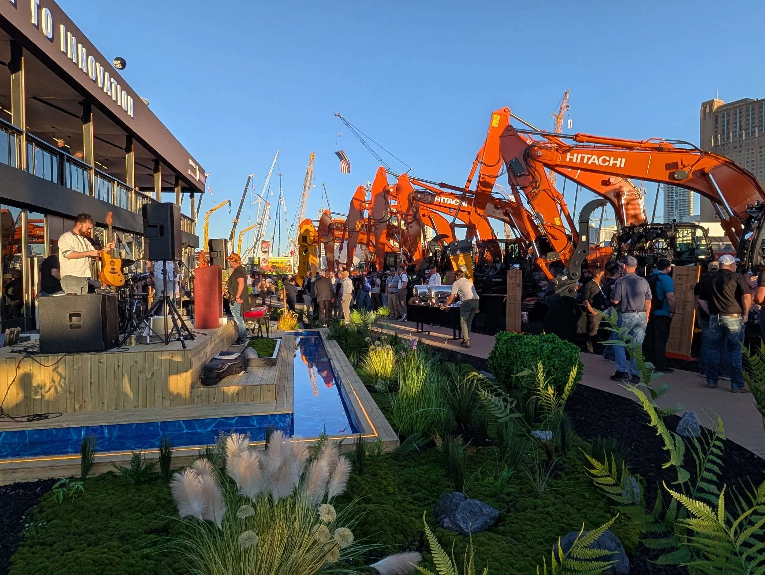
CONEXPO IN REVIEW: OUR MAIN TAKEAWAYS FROM ATTENDING THIS YEAR’S EVENT
If you work in the construction industry, chances are you’ve heard of CONEXPO unless you live under a rock (or are too busy excavating them). CONEXPO is the industry's largest trade show and networking event, hosted every 3 years in Las Vegas. This year, ECI was represented by Ray, President & Founder, and Nicole, Client Relations Manager. Read more to get their personal takes on how technology advancements are shaping the future of the industry.
BUILDING A CAREER IN CONSTRUCTION: OPPORTUNITIES WITHOUT LIMITS
Why choose construction? It's common to hear laborers say they need a career that doesn’t involve sitting at a desk all day. Amongst the various reasons people offer, the consistent feedback is that construction provides rewarding work and that hard work pays off. If you are committed and demonstrate a strong work ethic, you can move up the ladder quickly. Read more to find out the various career opportunities in construction.
THREE REASONS WHY GENERAL CONTRACTORS SHOULD CARE WHO BUILDS THEIR CIM MODELS
General Contractors are the spearhead of the project. It is up to you to find subcontractors who can fill the gaps in the services offered to complete the job. However, sometimes your subcontractors have to utilize vendors of their own. But how do you know that they are reliable, that they won’t make any mistakes? Read more to learn why general contractors should care who their site contractors use for creating 3D Models.
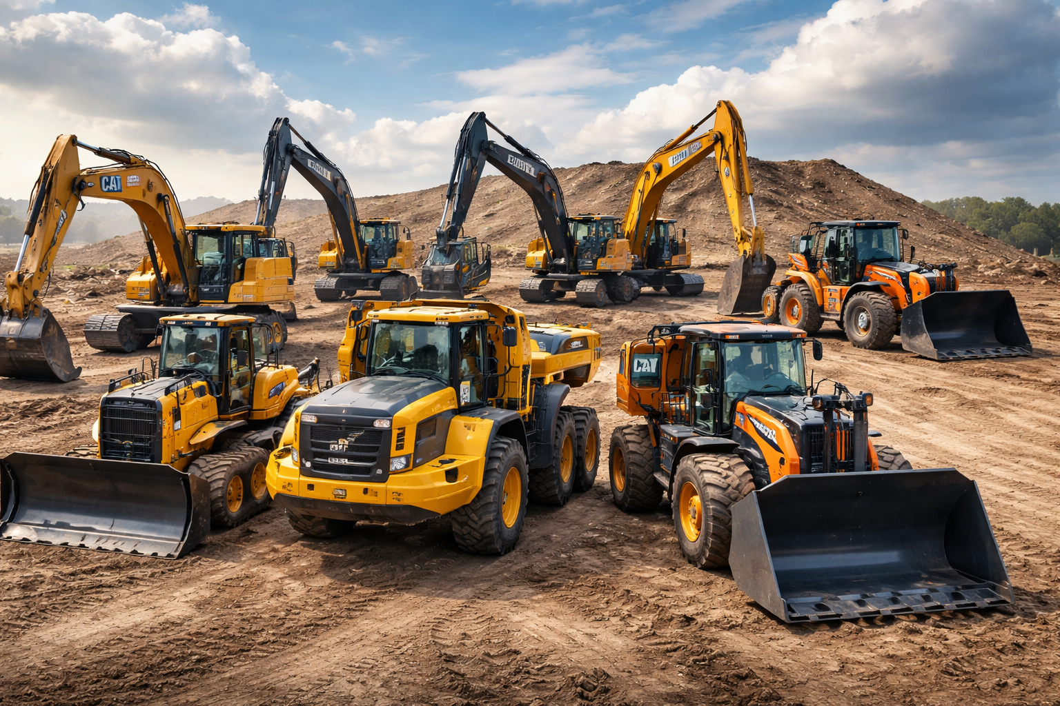
HOW A ONE-STOP SHOP IS THE RIGHT CHOICE FOR HEAVY EQUIPMENT RETAILERS AND CONTRACTORS
Found a one-stop shop? If so, you’ve hit the gold mine! If not, you should find one ASAP! Selecting who you want to conduct business with can be quite the ordeal, whether it's buying someone’s product or utilizing their services. You want to ensure that your provider is reliable. This extensive process eats up a lot of time that could be allocated to something more productive for your business. Read more to learn why finding a heavy equipment retailer that has an established partnership with a 3D modeler, or has an in-house branch is super helpful.
TIME IS RUNNING OUT… MAXIMIZE YOUR END-OF-YEAR SPENDING
Maximize your company's productivity while reducing your taxable income. Take advantage of Section 179 and add to your fleet. Read more to learn about the different manufacturers of heavy equipment, how to find your local dealership, and what popular end-of-year promotions.

OWNERSHIP VS RENTAL: FACTORS TO CONSIDER WHEN ACQUIRING HEAVY EQUIPMENT
Got a new project? In a competitive bidding environment having the right equipment can determine whether or not you win the job. Do you need to replace outdated machines, operate more efficiently within a growing workload, or even meet tight deadlines? Then it might be time to expand your capabilities by adding to your fleet. Read more to learn the advantages and disadvantages of purchasing versus renting equipment, and the advantages and disadvantages of buying new versus used equipment, to ensure you make the most logical and cost-effective decision based on your budget and timeline.

AVOID EVERY UTILITY CONTRACTORS’ BIGGEST HEADACHE AND INVEST IN GPS
What are utility contractors’ worst nightmares? Hitting existing utilities or a miscalculated slope for trenches for utility installation. Both scenarios cost companies abundantly through rework, failed inspections, delay projects project life cycle, and put their crew’s safety at risk. Read more to learn about how the emerging trend of technology is being used in utility construction and can prevent this nightmare from coming to life.

BUYING GUIDE: EVERYTHING YOU NEED TO KNOW WHEN BUYING A TRENCHER
Pick the wrong trencher, and you’ll spend more time fighting the ground than digging into it. From walk-behinds to ride-ons, wheels to tracks, here’s everything you should know before signing that purchase order.

FIVE REASONS CONTRACTORS SHOULD USE DRONES FOR DATA COLLECTION TO IMPROVE EFFICIENCY
“If it ain’t broke, don’t fix it.” But what if it could improve your performance? Drones aren’t here to fix what is broken; they are here to take what works and elevate it to its highest potential.

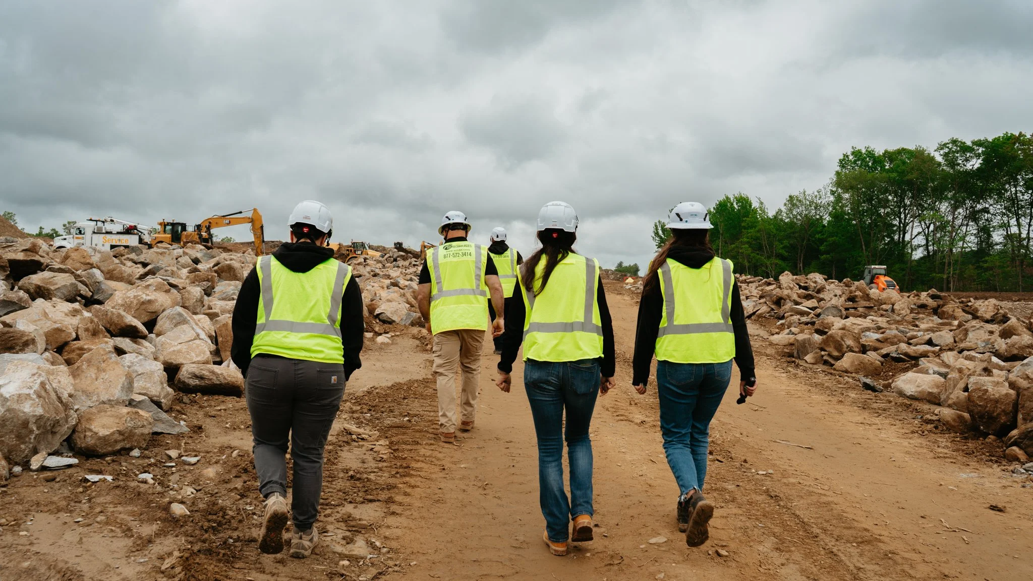
THE ART OF LOCALIZATION: TECHNIQUES FOR ESTABLISHING RELIABLE CONTROL IN THE FIELD
Control Points are the foundation of your project; they serve as physical reference points for the project's spatial framework, establishing accurate elevations and real-time location. In simpler terms, they are a point on the ground or any permanent structure whose horizontal and vertical location/position is known. Read more to learn the different techniques used to localize control points!

SAFE WORK SITES START WITH A PLAN, TRAINING, AND THE RIGHT TECHNOLOGY
Safety isn’t a checklist or simply throwing on a hard hat and going about your day. It is a promise that every worker gets to go home and see their families at the end of the day. Before the early 20th century, fatalities on-site were viewed as a price society was willing to pay for the sake of progress. Read more to learn about the common hazards onsite, how you can prevent them, and technology’s role in supporting safety onsite!

“I WILL FIND IT”: WHY THE DISAPPEARANCE OF REVISION CLOUDS IS A PROBLEM WORTH TRACKING
Revision clouds are a graphic symbol that visually highlights any modifications or updates made to the original drawing. The major benefits of revision clouds are that they save time in the review process, enhance record-keeping, and reduce miscommunication by ensuring nothing gets lost in the translation. Read more to learn about why architects/engineers no longer use them?

WHY GPS PRECISION IS THE MISSING TOOL IN YOUR LANDSCAPING WORKFLOW
Don’t be afraid to tap into the unknown when leveraging technology for your construction bids & projects. Technology is constantly evolving and enhancing the construction industry. A growing number of site contractors and landscapers have been using GPS machine control to improve the competitive nature that exists in this industry. Pursuing the endeavor of implementing GPS equipment can be daunting, especially when there is a lack of awareness surrounding the topic. Read further to learn more about how GPS equipment can help contractors and landscapers achieve success!

THE DANGERS OF BAD DESIGN DRAWINGS
One of the biggest headaches for contractors is bad design drawings. When architects make a mistake in the blueprints, serious consequences can transpire which can throw off the entire project. The use of technology and purchasing CAD services can combat receiving bad drawings. At ECI, our VCES are highly qualified, we can identify problems before any ramifications take place. Thus, saving contractors time and money. Keep reading to learn more about how bad design drawings can affect contractors and how to identify and try to avoid such errors!

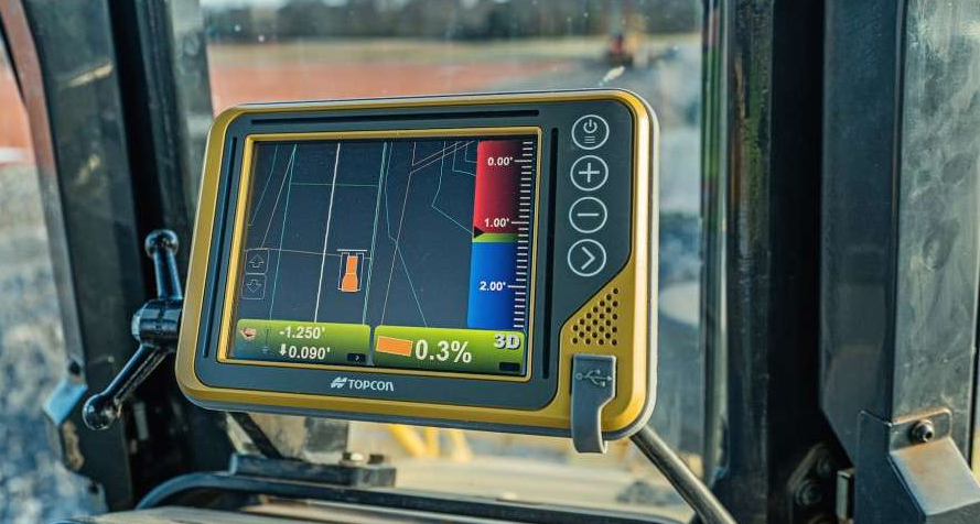
THE KEY DIFFERENCES BETWEEN 2D & 3D MACHINE CONTROL
Technology and machine control have taken over the construction industry and are the key factors driving earthwork efficiency. Do you want your site to run optimally? Do you want to improve the setup of your operators and in-house engineers for even more success?? If so, you should understand the differences between 2D and 3D machine control.

HOW ECI ACTS AS THE CATALYST FOR WINNING BIDS
Whether you have an estimator on staff or not, you are still limited in the number of bid submittals based on the employee’s capacity. Hiring a company like ECI for your cut/fill services allows you to increase the amount of jobs you bid. By not enlisting our assistance you risk the potential of more errors, resulting in having to spend more money in the long run. Why fly Spirit, when you can enjoy the luxuries of JetBlue?

HOW AGTEK SIMPLIFIES EARTHWORK AND COSTRUCTION PROJECT PLANNING
Winning bids in the construction industry resemble an all-star team aiming for the championship. To dominate you must remain relentless, push for more opportunities to score, and win project after project. Wayne Gretsky declared “You miss 100% of the shots you don’t take!” For contractors, software like Agtek ensures you never miss the opportunity to score. When it comes to winning bids, speed is a game-changer. In a competitive market, speed is a qualifying factor that can make or break the chance of securing the project. Agtek software simplifies earthwork calculations and optimizes construction project planning. Learn how it enhances accuracy, reduces costs, and increases efficiency for construction professionals.