
GPS ROVER AND BASE: FOR ALL-IMPORTANT ACCURACY, IT'S ALL ABOUT LOCATION
Rovers and base stations have been around and used in our industry for a long time. When paired with the GPS Real-Time Kinematic (RTK) operation, it gives you impeccable accuracy down to the centimeter. Choosing the best location for set up on the job site is the most crucial first step towards obtaining the best data possible. Base stations receive signals from GPS satellites and create a correction factor that eliminates errors in the GPS and then sends it to the rover. Rovers calculate grade, find exact locations and elevations, measure ground, saw cut, surface tie-in points, and as-built points. This blog will give you some suggestions on what to do and what not to do to get the most out of your GPS rover and base station.
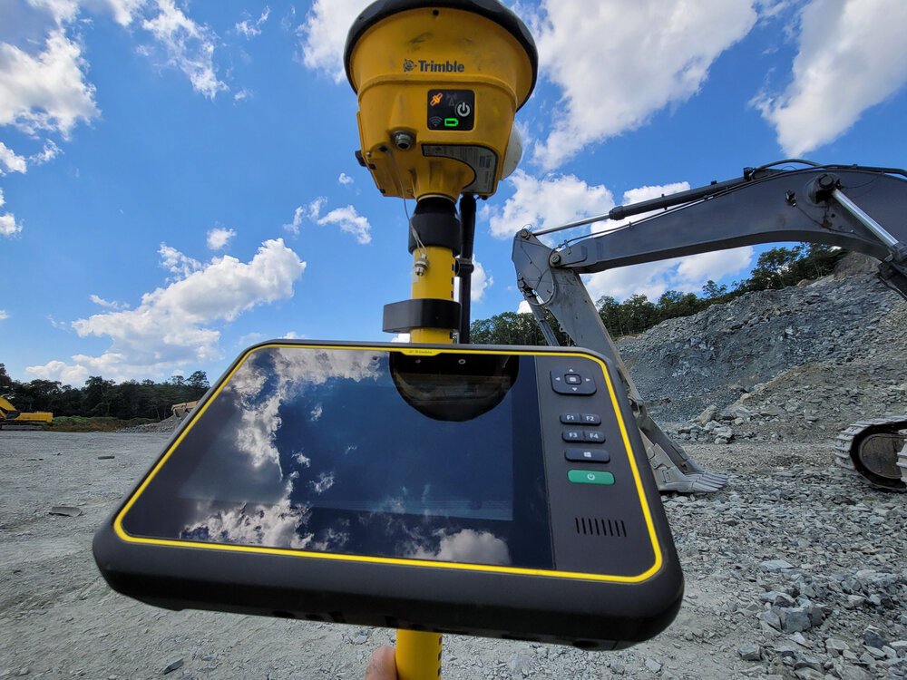
GPS Rover on job site
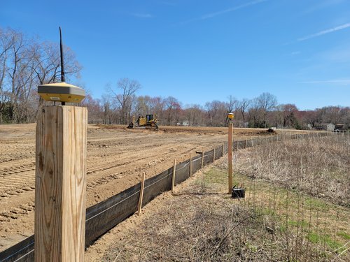
Base Stations Set-Up
There are times when your base station will be permanently or semi-permanently set up on-site for a long time, and other times when it will require a daily setup. Regardless of how long it will be set up, there are several critical considerations for getting the best results. You should choose a centrally located location on the job site where the range of the radio signal will be optimized, especially on larger job sites. By doing so, it will provide the best full coverage of the site. Whenever possible, you’ll want to set up your tripod directly above a control point. The GPS’s antenna must have an unobstructed line of sight to the sky in all directions – this is critically important! Avoid placing it near buildings, heavy machinery, overhead electrical lines, trees, any other large object which could impact its optimal functionality. Ensure that your tripod is as level as possible (a bubble indicator shows you if you’re level or not). Recording the antenna height from the control point is a great place to start. Once secured and level, your base station is set up and ready to transmit and receive information.
Optimizing Rovers
Topcon/Trimble Hybrid Base Set-Up
The more satellites that the rover can see, the better the positioning data that it can collect. For this reason, rovers are typically mounted on poles, vehicles, or other similar types of raised locations. In addition to rovers pinpointing exact areas, they are instrumental in measuring stockpiles and topsoil piles. When starting the rover, it is important to check-in at one or more control points to check for possible position and height errors. This best practice will help avoid costly mistakes caused by a bad setup. You want to ensure that you do not have the rover placed directly beneath or close to power lines because the electromagnetic fields can interfere with the operation of the GPS RTK.
If you’re experiencing setbacks due to your base stations or rover setups, contact one of ECI’s virtual construction engineers. They’ll be glad to troubleshoot with you and get your equipment working right.
Additional information on this topic can be found here.