
ECI Blog
Downloads


Tags
- 3D Digital Models 10
- 3d scanners 1
- AI in Construction 2
- AMG 1
- Artificial Intelligence 2
- As-Built 1
- Autocad 2
- Base and Rover 1
- Better meetings 1
- Big Data 3
- Big Data in Construction 3
- CAD 5
- CAD files 4
- Cad Services 1
- Changes in Construction 2
- Civil GPS systems 7
- Communication 2
- Conexpo 1
- Construction Data and Safety 5
- Construction Project Bidding 6
- Construction Takeoffs 7
- Construction control site networks 3
- Construction planning 2
- Construction projects 6
- Control Points 3
- Curbs 1
- DEM 1
- DSM 1
- DTM 4
- Dig safe 2
- Digital takeoffs 6
- Drone data 3
- Drones 2
- Earthwork drones 1
- Electronic Distance Measuring 1
- Ellipsoids 1
- Excavation Safety 2
- Excavation bidding process 3
- Excavation hybrid fleet 1
- GPS Machine Calibration 3
- GPS equipment software 5
- GPS/GNSS 8
- Geoids 2
- Heavy Equipment GPS 8
- Lidar 2
- Milling and Paving 1
- Milling and Paving Technologies 3
- Orthophotos 2
- Point Cloud 1
- RTK 3

EXAMINING HOW REWARDING A CAREER IN CONSTRUCTION CAN BE
The years fly by, and we live in a world of constant change but when it comes to building a career in construction, several things stand to the test of time. One of those constants is that in our industry, there will almost always be more projects than there are laborers to work on them. Proving this still remains true today is the fact that this theme came up again recently when Ray attended Build Witt’s first Dirt Summit in Houston, TX last month.

HOW TO MEASURE THE ROI OF CIM
By bringing together virtual models, data analytics, systems, people, and improved workflows through CIM you will gain efficiencies in every phase. Stakeholders will be able to easily access and rely on accurate and timely information which will enable them to do their jobs better. Your projects will not run behind schedule as often and your overall costs will decrease.
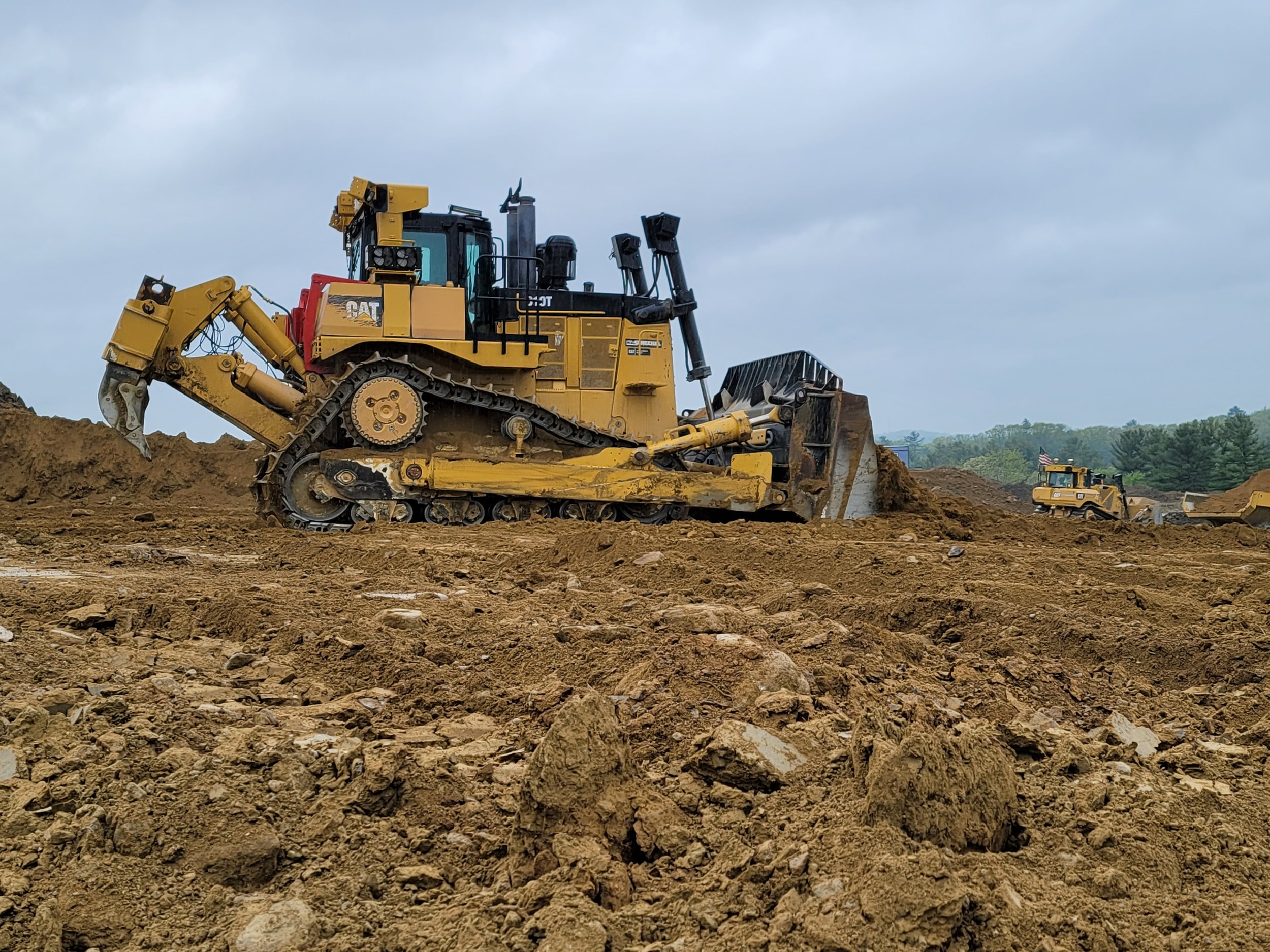
BULLDOZERS: ALL YOU SHOULD KNOW ABOUT THEM AND HOW GPS IMPROVED THEM
For GPS to work successfully and efficiently in earthwork, there must be accurate 3D models loaded into the dozer or other heavy machinery. GPS has become more of the industry standard, and we expect there will not be many site contractors running projects without GPS on their equipment. The benefits are far too great not to make the switch.