
ECI Blog
Downloads


Tags
- 3D Digital Models 10
- 3d scanners 1
- AI in Construction 2
- AMG 1
- Artificial Intelligence 2
- As-Built 1
- Autocad 2
- Base and Rover 1
- Better meetings 1
- Big Data 3
- Big Data in Construction 3
- CAD 5
- CAD files 4
- Cad Services 1
- Changes in Construction 2
- Civil GPS systems 7
- Communication 2
- Conexpo 1
- Construction Data and Safety 5
- Construction Project Bidding 6
- Construction Takeoffs 7
- Construction control site networks 3
- Construction planning 2
- Construction projects 6
- Control Points 3
- Curbs 1
- DEM 1
- DSM 1
- DTM 4
- Dig safe 2
- Digital takeoffs 6
- Drone data 3
- Drones 2
- Earthwork drones 1
- Electronic Distance Measuring 1
- Ellipsoids 1
- Excavation Safety 2
- Excavation bidding process 3
- Excavation hybrid fleet 1
- GPS Machine Calibration 3
- GPS equipment software 5
- GPS/GNSS 8
- Geoids 2
- Heavy Equipment GPS 8
- Lidar 2
- Milling and Paving 1
- Milling and Paving Technologies 3
- Orthophotos 2
- Point Cloud 1
- RTK 3

HOW MODEL PREP IMPROVES RESIDENTIAL SUBDIVISION SITE DEVELOPMENT
Residential subdivisions have steadily grown in popularity since their development in the 1940s. They require careful and thorough planning. To obtain the required approvals for construction to begin, it is also necessary to gather site plans, topo surveys, diagrams, and any other relevant project data. Included within the site plan is the layout and grading plan for the site, and that’s where we can get involved to assist with your data prep.

SPOT ELEVATIONS: WHEN TO USE THEM INSTEAD OF CONTOUR LINES
Are you having trouble deciding when to use spot elevations versus contour lines to determine your breaklines? Well, don't worry because you're not alone. We are often confronted with that question and are here to help you figure it out.
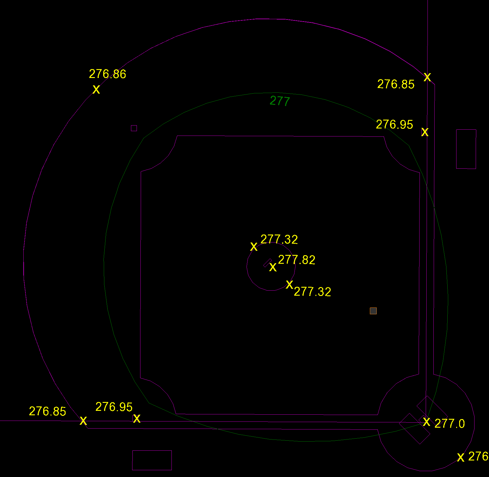
BREAKLINES: WHAT ARE THEY AND WHY ARE THEY IMPORTANT IN SURFACE MODELS
Breaklines are essential for creating a precise 3D surface model. Breaklines connect data representing specific features on a surface, such as the centerline of a road, a ridgeline, or a ditch's flowline. Whether to use spot elevations or contour lines to determine your breaklines is not always clear. Here, we help shed some light on the differences between contour lines and spot elevations and provide guidance on when to use which one.