Learning Center
Downloads


Tags
- 3D Digital Models 8
- 3d scanners 1
- AI in Construction 1
- AMG 1
- Artificial Intelligence 1
- As-Built 1
- Autocad 2
- Base and Rover 1
- Better meetings 1
- Big Data 2
- Big Data in Construction 3
- CAD 5
- CAD files 4
- Cad Services 1
- Changes in Construction 2
- Civil GPS systems 5
- Communication 2
- Conexpo 1
- Construction Data and Safety 5
- Construction Project Bidding 6
- Construction Takeoffs 6
- Construction control site networks 3
- Construction planning 2
- Construction projects 6
- Control Points 3
- Curbs 1
- DEM 1
- DSM 1
- DTM 4
- Dig safe 2
- Digital takeoffs 6
- Drone data 3
- Drones 2
- Earthwork drones 1
- Electronic Distance Measuring 1
- Ellipsoids 1
- Excavation Safety 2
- Excavation bidding process 3
- Excavation hybrid fleet 1
- GPS Machine Calibration 3
- GPS equipment software 4
- GPS/GNSS 8
- Geoids 2
- Heavy Equipment GPS 6
- Lidar 2
- Milling and Paving 1
- Milling and Paving Technologies 2
- Orthophotos 2
- Point Cloud 1
- RTK 3

CIVIL ENGINEERING AND LANDSCAPE ARCHITECTURE: TWO EXCELLENT PROFESSIONS IN CONSTRUCTION
Continuing our support for Careers in Construction month by giving you information about two exciting professions: civil engineering, and landscape architecture. Some might think they’re very similar, however, they differ quite a bit.

ROAD GRADERS WITH GPS ARE A MUST HAVE FOR YOUR HEAVY EQUIPMENT FLEET
Dozers are arguably the coolest piece of heavy equipment out there; however, we can make a strong case for the road grader. Long gone are the days of graders being pulled by horses and tractors! The power and versatility of a modern-day road grader are two of the top reasons we consider it to compete with the dozer for being badass.

3 PROVEN AND EFFECTIVE STRATEGIES FOR BETTER PROJECT OUTCOMES
There is so much for a PM to consider when managing a construction project. Establishing and maintaining effective monitoring and control protocols improves project success. With so many moving parts and the potential for changes arising at any point, how can you best monitor and control your job site?
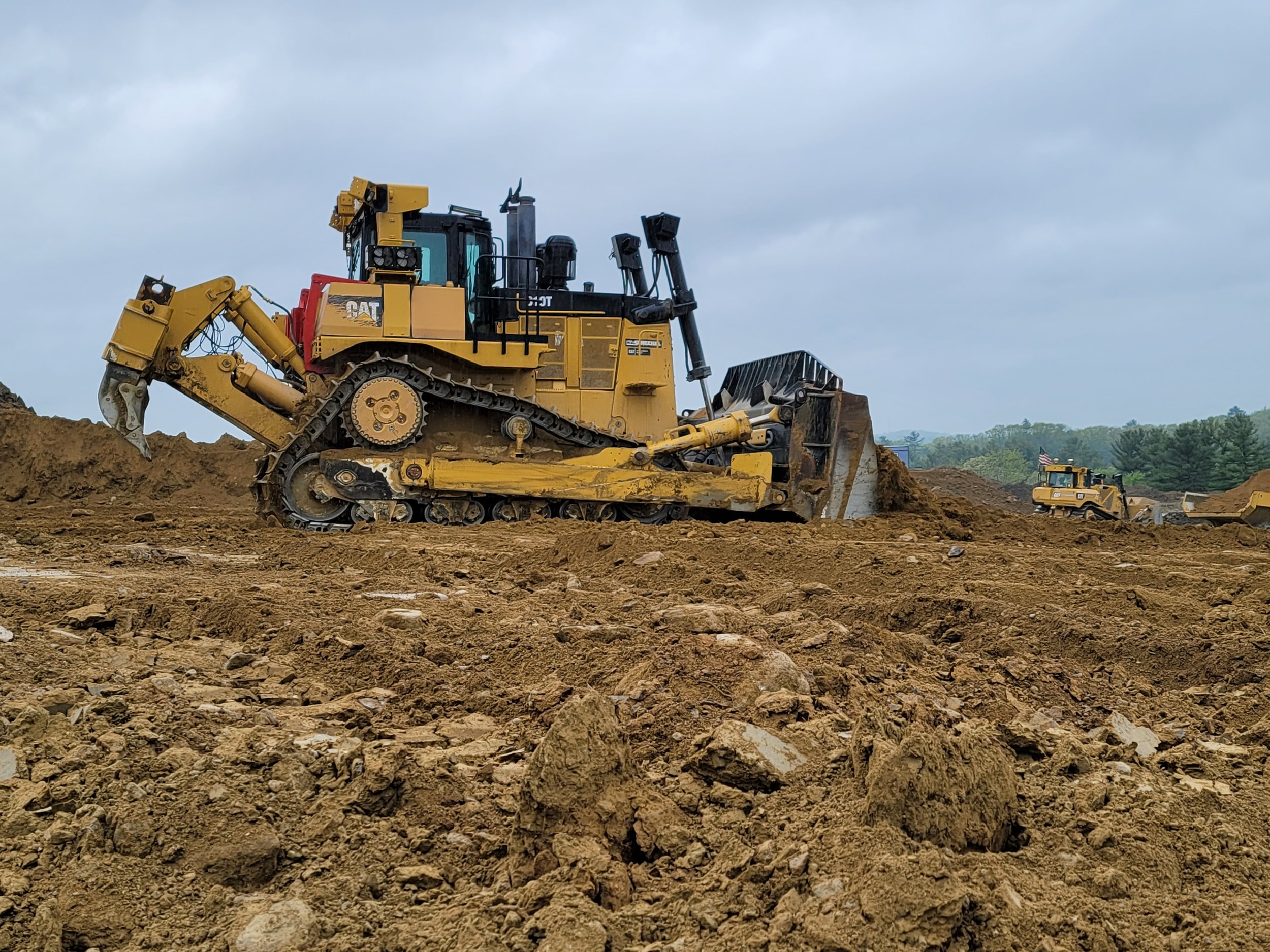
BULLDOZERS: ALL YOU SHOULD KNOW ABOUT THEM AND HOW GPS IMPROVED THEM
For GPS to work successfully and efficiently in earthwork, there must be accurate 3D models loaded into the dozer or other heavy machinery. GPS has become more of the industry standard, and we expect there will not be many site contractors running projects without GPS on their equipment. The benefits are far too great not to make the switch.

HOW BEST TO DEPLOY BASE STATIONS AND VIRTUAL REFERENCE STATIONS
Land surveyors have been using GPS receivers at a known position, called base stations, for a long time, and that method continues to be effective and used a lot. However, there's also the option of using a virtual reference station (VRS) instead of a base station. A VRS is a technique for network RTK for GPS systems. How do you choose between a base station and a VRS? Well, there are pluses and minuses with each system, so it depends.

THE IMPORTANCE OF COMPLYING WITH ADA IN CONSTRUCTION AND HOW ECI HELPS
The American Disabilities Act of 1990 (ADA) is one of the most important considerations that must be factored into all construction projects, whether new construction or renovation. Numerous ADA guidelines must be followed when constructing, for example, sidewalks, ramps, parking spaces, or buildings. Not following them will result in hefty fines, which can reach as high as $150,000 depending on the number of violations.
Videos

Consideration When Buying a Drone

What Happens When You Start Working with ECI

How ECI Gives Your In-house GPS a Boost

How Much Does A Road Model Cost?